Gulf Oil Leak and Safe Harbor

September, 2010 FINAL UPDATE:

THE OIL HAS NOT GONE AWAY...THE GULF IS FULL OF CHEMICAL DISPERSANT, THE OIL HAS MOVED UP TO 300 MILES FROM THE LEAK, OIL BLANKETS THE BOTTOM AND IS MOVING IN SUBSURFACE LAYERS UP TO 3 MILES LONG.

THE EPA (ENVIRONMENTAL PROTECTION AGENCY) JUST CONTACTED ME TO THANK US FOR OUR EFFORTS. THEN WENT ON TO INFORM US THAT OUR PRODUCT HAD NOT BEEN REGISTERED AND THAT WE SHOULD DO THAT AND SUBMIT IT TO BP.....I TOOK A LONG MOMENT TO BREATHE...WE HAD NO PRODUCT, WE HAD DEVELOPED AN INNOVATIVE, SUSTAINABLE SYSTEM FOR PASSIVELY COLLECTING OIL BEFORE IT HIT THE COAST, USING ALL EXISTING MATERIALS AND TECHNOLOGIES CURRENTLY AVAILABLE IN THE GULF...WE HAD MADE OUR SYSTEM PUBLIC DOMAIN, AVAILABLE AT NO COST TO ANYONE WHO COULD USE A BARGE, OIL BOOMS AND ANCHORS...I TOOK ANOTHER LONG BREATH...AND LET IT ALL GO.

Thank you to Maryam Wagner, from the American Educational Research Association, who has provided us with more information on the BP oil spill timeline and aftermath in the following links:

http://krilloil.com/blog/the-deepwater-horizon-oil-spill-and-its-aftermath/

http://www.bloomberg.com/news/2013-02-25/bp-gulf-of-mexico-spill-from-disaster-to-trial-timeline.html

http://www.wsws.org/en/articles/2010/05/spil-m14.html

http://cen.acs.org/articles/91/i22/Deepwater-Horizon-Disaster.html

Gulf Oil Leak and Safe Harbor

May 25 Update: 

The Gulf Stream Loop Current, which did pick up a tendril of oil, periodically reconfigures itself into an isolated loop. This has just happened, which means the cut off loop may have a lower probability of transmitting oil to the Gulf Stream. An updated, May 25th image is shown directly below and an earlier image is below that.


Gulf Oil Leak and Safe Harbor

May 25 Update:

The link below shows an illustrated video concept, from an experienced oil worker, who simply wants his idea considered. This man's experiences are very familiar to Safe Harbor.

http://cbs11tv.com/oilspill/gulf.oil.spill.2.1704112.html

In the relative silence of many politicians, for reasons yet to be determined, Louisana Governor Bobby Jindal has emerged into a position of leadership. Our country's natural resources are held in a public trust. We are all stakeholders. When we watch an ever growing, toxic blanket being allowed to take 20,000 square miles of our fisheries and potentially hundreds of miles of coastal ecosystems, off line, we are bearing witness to a violation of that public trust which our elected officials are not protecting.

Our comments on the coastal bird rescue plan:

Species don't exist individually but within systems.

The ability of sustainable natural resource systems to adapt to an event of this magnitude are marginal. When a system is overwhelmed by stress and cannot adapt, it reaches a tipping point.  The system will collapse and reconfigure, perhaps unpredictably. The individual species can no longer be supported.

We need to consider the unthinkable, that bird, fish and animal populations previously supported by the system may be lost. Even if we could handle say, 34,000 phone calls and rescue 34,000 birds, there would be no supportive resource system to return them to and translocating that many individuals somewhere else would stress other resource systems.

Our recent concerns focused on the increasing probability of interactions between the spill shield and the Gulf Stream Loop that runs through the Gulf of Mexico. The spill shield and a developing Gulf Stream Loop eddy current were already in proximity and the spill contimnues spreading. We expect predictability to diminish with growth of the spill. http://ocg6.marine.usf.edu/~liu/oil_spill_ensemble_forecast.html

Gulf Oil Leak and Safe Harbor

May 18 Update:

In Gulf Spill, BP Using Dispersants Banned in U.K. by Marian Wang, ProPublica - May 18, 2010 2:24 pm EDT

The two types of dispersants BP is spraying in the Gulf are banned for use on oil spills in the U.K. As EPA-approved products, BP has been using them in greater quantities than dispersants have ever been used in the history of US oil spills.

BP is using two products from a line of dispersants called Corexit, which EPA data appears to show is more toxic and less effective on South Louisiana crude than other available dispersants, according to Greenwire.

We learned about the U.K. ban from a mention on the New York Times' website. (The reference was cut from later versions of the article, so we can't link to the Times, but we found the piece elsewhere.) The Times flagged a letter Rep. Edward Markey, Chairman of the House Subcommittee on Energy and Environment, sent to the EPA yesterday. The letter pointed out that both the Corexit products currently being used in the Gulf were removed from a list of approved treatments for oil spills in the UK more than a decade ago.

Gordon Peabody of Safe Harbor and Congressman Markeywere interviewed live, along with a Florida island Mayor, on the Emily Rooney Show regarding the spill. Click on the link below. The interview begins with Congressman Markey, goes to the Mayor and then to Gordon about 1/4 of the way through the download. The second half of her show has a different topic.

Title: The Emily Rooney Show 5/17/10

Link: http://www.wgbh.org/programs/programDetail.cfm?programid=854&featureid=11904&rssid=4

Gulf Oil Leak and Safe Harbor

May 17 Update:

The spill shield is entering the Gulf Stream Loop. Official responses have barely confirmed this but check the 4 models yourselfhttp://www.capecodonline.com/apps/pbcs.dll/article?AID=/20100505/NEWS/5050317

From the New York Times online:

Scientists are finding enormous oil plumes in the deep waters of the Gulf of Mexico, including one as large as 10 miles long, 3 miles wide and 300 feet thick in spots. The discovery is fresh evidence that the leak from the broken undersea well could be substantially worse than estimates that the government and BP have given.

There's a shocking amount of oil in the deep water, relative to what you see in the surface water, said Samantha Joye, a researcher at the University of Georgia who is involved in one of the first scientific missions to gather details about what is happening in the gulf. There's a tremendous amount of oil in multiple layers, three or four or five layers deep in the water column.

The plumes are depleting the oxygen dissolved in the gulf, worrying scientists, who fear that the oxygen level could eventually fall so low as to kill off much of the sea life near the plumes.

Dr. Joye said the oxygen had already dropped 30 (Italics by Safe Harbor) percent near some of the plumes in the month that the broken oil well had been flowing. If you keep those kinds of rates up, you could draw the oxygen down to very low levels that are dangerous to animals in a couple of months, she said Saturday. That is alarming.

The plumes were discovered by scientists from several universities working aboard the research vessel Pelican, which sailed from Cocodrie, La., on May 3 and has gathered extensive samples and information about the disaster in the gulf.

From CBS 60 Minutes: 

Oil Spill Blame Game Over: 60 Minutes Uncovers Severe BP Negligence Led to Explosion (Video) : TreeH

Gulf Oil Leak and Safe Harbor

May 14 Update:

The ambitious Republican governors of Mississippi and Louisiana are a study in contrasts as an oil spill threatens coastal economies still reeling from Hurricane Katrina.

Mississippi's Haley Barbour, a well-connected former Washington lobbyist, has calmly said the oil slick looming offshore is just a sheen in most places and there's no reason for people to panic.

Louisiana's Bobby Jindal, meanwhile, has questioned oil giant BP PLC's response capability and the federal government's plans to clean up crude spewing from a well blown out by an offshore oil rig explosion April 20. He activated the Louisiana National Guard and called on coastal parish leaders to draw up their own response plans after saying he couldn't get answers from BP or the Coast Guard.

BP and government officials have pegged the leak resulting from the Deepwater Horizon rig disaster at 5,000 barrels a day, or about 200,000 gallons. But a scientist who analyzed the video of the gushing pipe said Thursday the oil flow appeared to be much greater.

Soon after the explosion three weeks ago, the government said oil and gas were flowing from the seabed at a rate of 210,000 gallons or 5,000 barrels a day. Now, after viewing the video, some scientists calculate it at 2 million gallons a day or even higher.National Public Radio reported yesterday that there could be 10 times as much oil coming out as the previous estimate of 5,000 barrels per day. Which raises some big questions about whether BP is being honest about the size of the spill.

Safe Harbor and Gulf Oil Leak

MAY 12 UPDATE:

The committee said that there were at least "four significant problems with the blowout preventer" used on the Deepwater Horizondrill rig.

Rep. Bart Stupak, D-Mich., said that a 2001 report by Transocean, which made the device, indicated there can be as many as 260 failure possibilities in the equipment. The device is supposed to be the final safeguard against a well blowout by clamping down and sealing a gushing oil well.

About 325,000 gallons of dispersant have been used, although scientists warn it may kill marine life

A relief well is being drilled but could take many weeks

A huge steel funnel suffered a build-up of ice-like crystals and had to be put aside

They're going to take a bunch of debris, shredded up tyres, golf balls and things like that, and under very high pressure shoot it into the preventer itself and see if they can clog it up and stop the leak," he told CBS television.However, experts have warned that any further damage to the blowout preventer - a huge valve system meant to turn the oil off - could see it shooting out at 12 times the current rate.

Gulf Oil Leak and Safe Harbor

MAY 10 UPDATE:

At the site of the ruptured well a mile underwater, a remote-controlled submarine shot chemicals into the maw of the massive leak to dilute the flow, further evidence that BP expects the gusher to keep erupting into the Gulf for weeks or more.

Crews using the deep-sea robot attempted to thin the oil — which is rushing up from the seabed at a pace of about 210,000 gallons per day after getting approval from the Environmental Protection Agency, BP PLC officials said.

Two previous tests were done to determine the potential impact on the environment, and the third round of spraying was to last into early Tuesday.

Gulf Oil Leak and Safe Harbor

MAY 10 UPDATE:

At the site of the ruptured well a mile underwater, a remote-controlled submarine shot chemicals into the maw of the massive leak to dilute the flow, further evidence that BP expects the gusher to keep erupting into the Gulf for weeks or more.

Crews using the deep-sea robot attempted to thin the oil which is rushing up from the seabed at a pace of about 210,000 gallons per day after getting approval from the Environmental Protection Agency, BP PLC officials said.

Two previous tests were done to determine the potential impact on the environment, and the third round of spraying was to last into early Tuesday.

The EPA said the effects of the chemicals were still widely unknown.

Safe Harbor and Gulf Oil Leak

MAY 6 UPDATES

Coast Guard contacted us, suggesting our concept was under consideration and being forwarded to Horizon response center at unified command. The amount of oil collected to this point may be equivalent to between one and two day's discharge.


Update: May 06, 2010 | By Richard Fausset and Jill Leovy, Los Angeles Times, and Jim Tankersley, Tribune Washington Bureau

Rick Loomis, Los Angeles Times BP officials Tuesday told congressional representatives that the Gulf of Mexico oil spill could grow at a rate more than 10 times current estimates in a worst-case scenario greatly enlarging the potential scope of the disaster.

Most of the handful of congressional Democrats and Republicans who met with representatives from BP, Transocean Ltd. and Halliburton in a closed-door briefing on Capitol Hill walked away unimpressed.

A source who attended the meeting said that the companies' representatives had a "deer in headlights" look and that the tenor of the conversation was that the firms "are attempting to solve a problem which they have never had to solve before at this depth at this scope of disaster. They essentially said as much."

More than 400 species of wildlife, including whales and dolphins, face a dire threat from the spill, along with Louisiana's barrier islands and marshlands. In the national refuges most at risk, about 34,000 birds have been counted, including gulls, pelicans, roseate spoonbills, egrets, shore birds, terns and blue herons.

To address potential wildlife impacts, BP has contracted with Tri-State Bird and Rescue. If oiled or injured wildlife is spotted, people are urged not to attempt to help the animals but to report them to (800) 557-1401.

Gulf Oil Leak and Safe Harbor

MAY 3 UPDATE

As of May 3rd, these materials were received by the White House Department of Energy, BP Horizon Response Center and other entities involved in the spill response. Our concepts are now public domain. The heart of our system is based on "not chasing the oil with collection systems but using natural forces to guide the floating oil to fixed collection systems.

BP, through their Horizon "Call Center", instructed Safe Harbor on May 3rd, to send in a proposal for funding consideration..Strange as it seems, the alternative response technology they are seeking, when it actually exists, as in our innovative concept, must be sold and we are finding nowhere to give it away..

By afternoon on May 3rd, they are now directing all input towards BP's emergency web site...Many of these sites are one way informational web sites. All communications have now been bundled through call centers and handled by emergency response consultants.The leadership has been reconfigured, with the Coast Guard seemingly on the point, and renamed "Unified Incident Command" or Unified Command". "Vessels of Opportunity" are currently being solicited and about 200 have signed up as of May 3rd. Also as of May 3rd, about 50 miles of containment booms have been deployed, with 130 more miles in reserve. Much of the boom line is within the estuary areas, which are connected to the Gulf.

Gulf Oil Leak and Safe Harbor

Spring, 2010 will be remembered not only because we witnessed a lifetime, environmental tragedy unfolding in what appeared to be slow motion in the Gulf of Mexico but we were also forced to witness a level of denial, misrepresentation, self protection and poorly represented science, while a major environmental resource, held in a public trust, was allowed to fall apart before our eyes.

May 1, 2010: Following these sketches you will find our rationale and after that you will find relevant links and continuing updates from the Gulf.

Safe Harbor has developed these innovative, alternative response concepts, following a phone discussion with an engineer from the Gulf of Mexico, who was seeking new ideas for dealing with the overwhelming oil spill.  These concepts were developed over a long weekend by an adhoc group, put together by Safe Harbor. Our concept addressed the request for "Alternate Response Technology" but what we really did was to look at all available, existing materials and technologies and just reconfigure them. These concepts reduce worker exposure to carcinogenic raw oil, reduce effort significantly and provide more effective collection. These conceptual sketches were executed by LEED Certified, Sustainable Architect Joy Cuming of Aline Architecture in Orleans, MA.

For some perspective, about 300 miles of coastline may be directly impacted. The Gulf coastline north of the spill area, stretches more than 800 miles. If the prevailing, seasonal southerly winds continue, much of this coast may be at risk. If southwest winds blow, Florida's 300 mile Gulf Coast will additionally be at risk and IF the wind should blow from the north..the Gulf Coast of Florida may be spared but the Gulf Stream, which loops near the spill, will be impacted and transport oil first to the reefs of the Florida Keys, and then to Miami beaches, followed by the Outer Banks and on into the North Atlantic Ocean and the east coast. Mexico, Cuba and the Bahamas may eventually find this oil in their coastal ecosystems and on beaches. Most likely, with 3 different leaks now reported and a long term scenario looming, all of these things may happen. Downplaying these possibilities sort of ignores the truth of possibly a quarter million gallons, or more, being added to the equation each day.

Rationale: In the current scenario, recovery and mitigation require long term, sustainable concepts for collection. Using sustainable and passive principles, we reviewed existing technology, in place materials and available vessels. Our concept considers a reconfiguration of existing elements, which could contribute to increased remediation and reduced effort. This concept would also minimize exposure of emergency workers to carcinogens in recovered oil.

With this concept, floating oil would be delivered, by natural forces, to the collection areas, instead of collection systems chasing oil. Collection booms would be used to direct the floating oil instead of trying to encircle it. This would reduce effort and materials. Conceptual configuration can be left in place for prevailing winds and reconfigured in response to changing winds.

System # 1. Locally available barges from the Gulf Coast would be retrofitted with existing technology oil collection systems, powered by wind energy with a back up generator. Barges (see detail sketches) can operate with a high degree of automation. Collection booms (see concept sketch) can be reconfigured, utilizing wind pressure to drive surface oil to collection system passively. Pairs of barges would be anchored at the head of the crescent shaped containment booms. Collected, reclaimed oil would be stored in tanks and pumped into service tankers for further separation and industrial use ashore.

System # 2. Locally available barges from the Gulf Coast would be fitted with wind generators.  Sustainable energy would power circulation and dispersal systems for cultures of patented bioremediation bacteria. The barges would be anchored in place, with dispersal hoses between them. The bacteria would be maintained at maximum, reproductive temperature by circulation through passive solar, dark painted deck tank. Dispersal system would consist of measured release openings, along lengths of surface floating hoses, balanced by controlled intake of oil/water medium, powered by a circulation pump. This same system could be utilized, by adding 24/7 day lighting, to reintroduce indigenous phytoplankton.

Ryder Beach Partnership

RYDER BEACH PARTNERSHIP RESTORES TOWN LANDING.

The Town Landing at Ryder Beach has experienced tremendous wind erosion during the past few years. Winter winds created a "shotgun blow out" that eroded 14 feet of sand from the beach end of the walkway and deposited it in a 14-foot mound at the top of the walkway. This created a 28' drop and climb for beach goers.

Safe Harbor partnered with Truro Department of Public Works, volunteering services to facilitate restoration permitting and planning. This was an unusual project because we needed to balance natural resources with public use. Before work could begin, the proposal was reviewed by private property abutters, the Beach Committee, Truro Conservation Commission, Department of Environmental Protection and the Natural Heritage and Endangered Species Program(NHESP, under the MA Endangered Species Act).

The basic components of the project were pretty much like putting cookies back into the cookie jar. DPW Director Paul Morris moved eroded sand back to where it came from.  DPW workers installed 500 feet of 4' sand fencing to outline a walkway designed to prevent future wind erosion. Safe Harbor workers installed 800 feet of innovative 24" sand control fencing along the restored dune line for short-term collection of wind-blown beach sand. DPW and Safe Harbor worked together to plant 5,000 stems of beach grass. This will provide a sustainable system to capture and hold wind blown sand at the dune line. A neighbor brought out homemade Scottish shortbread cookies.  Safe Harbor planted another thousand stems of grass, reclaimed from the sand removal process, along the walkway. We advocate salvaging and reusing native vegetation from coastal projects. Long term control of public access, short-term sand fencing and long-term vegetation will create a sustainable system protecting natural resources and public

RYDER BEACH PARTNERSHIP RESTORES TOWN LANDING.

The Town of Truro on Cape Cod has experienced tremendous wind erosion during the past few years at one of their coastal beach access points, known as "town landings". Winter winds created a "shotgun blow out" that eroded 14 feet of sand from the beach end of the walkway and deposited it in a 14-foot mound at the top of the walkway. This created a 28' drop and climb for beach goers.

Safe Harbor partnered with Truro Department of Public Works, volunteering services to facilitate restoration permitting and planning. This was an unusual project because we needed to balance natural resources with public use. Before work could begin, the proposal was reviewed by private property abutters, the Beach Committee, Truro Conservation Commission, Department of Environmental Protection and the Natural Heritage and Endangered Species Program  (NHESP, under the MA Endangered Species Act).

The basic components of the project were pretty much like putting cookies back into the cookie jar. DPW Director Paul Morris moved eroded sand back to where it came from.  DPW workers installed 500 feet of 4' sand fencing to outline a walkway designed to prevent future wind erosion. Safe Harbor workers installed 800 feet of innovative 24" sand control fencing along the restored dune line for short-term collection of wind-blown beach sand. DPW and Safe Harbor worked together to plant 5,000 stems of beach grass. This will provide a sustainable system to capture and hold wind blown sand at the dune line. A neighbor brought out homemade Scottish shortbread cookies.  Safe Harbor planted another thousand stems of grass, reclaimed from the sand removal process, along the walkway. We advocate salvaging and reusing native vegetation from coastal projects. Long term control of public access, short-term sand fencing and long-term vegetation will create a sustainable system protecting natural resources and public access.

FOR QUESTIONS, CONTACT THE TRURO CONSERVATION COMMISSION OR EMAIL GORDON PEABODY

Understanding the Coastal Process

WORKING IN AREAS OF CRITICAL CONCERN: ENVIRONMENTAL EDUCATION SERIES

Download "Understanding The Coastal Process"

The Earth's three-dimensional landforms traditionally represent symbols of security. Things are very different on Cape Cod which is a temporary creation of glacial sand. Our three-dimensional landform is constantly being refined by another dimension: the fourth dimension of time. The four dimensional model does not symbolize security the grains of sand we live on were once mountaintops, thousands of feet high, hundreds of thousands of years ago. Weathering (exposure to the elements) de-constructs mountains chemically and physically, leaving behind indestructible granite particles. These sandy, mountain memories were carried down thaw swollen brooks and stream into rivers. The river's journey is over when it finds the sea. The burden of sand can be released. Heavier sand drops out near the coast, while finer, lighter particles are carried out to sea. Moon generated tidal currents, run parallel to the coast, transporting sand up and down the coastline. Wind generated wave patterns deliver the sand shoreward onto beaches. Seasonal winds continue moving this sand from beaches into sand dunes. The dunes closest to the beach have the heaviest sand particle mix. The dunes furthest from the beach have the lightest particle mix.

June 12, 1984 Cape Cod - image source: NASA Earth Observatory

June 12, 1984 Cape Cod - image source: NASA Earth Observatory

August 17, 2008 image source: NASA Earth Observatory

August 17, 2008 image source: NASA Earth Observatory

During the last hundred thousand years or so, New England's coastal beaches had a visit from another mountain. This time it was a mountain of ice. Nearly a mile thick, grinding inexorably and crudely down from the north. Heavy enough to depress our continental plate, this thousand mile wide bulldozer stole boulders, cobbles, stones and beach sand on its way south. Where cape cod sits today, warmer weather patterns melted ice as fast as it advanced. This glacial aftermath was first exposed to daylight around twelve thousand years ago. Climate change and subsequent advances and retreats of the glacier eventually left a four hundred foo high pile of sandy rubble where Cape Cod is today. At that time Cape Cod was several hundred feet above the dry coastal plate, reaching eastwards a mile or two further than it sits today. Compressed layers of bright sand and colored dark clay marked the glacial seasons of high and low melt-water flow. Small greenish stones found on our beaches are olivine, from the laurentian field in Canada. Six thousand years ago, give or take, rising sea level from the melted glacier reached Cape Cod, to begin taking back what it had left behind.  

THE OUTER CAPE'S EAST-FACING SHORELINE IS A LIVING "WORKSHOP IN PROGRESS", DEMONSTRATING THE PRINCIPLES OF COASTAL PROCESS. OCEAN STORM ENERGY CREATES WAVES THAT ERODE BEACHES. BEACH EROSION CAUSES COASTAL BANKS TO COLLAPSE. COLLAPSED BANKS CREATE A "TOE" AT THE BASE OF THE NEW BANK. THE TOE ERODES ONTO THE BEACH AND THE BEACH MAY ERODE UP INTO THE TOE. WHEN BEACHES ABSORB STORM GENERATED WAVE ENERGY, SAND IS CARRIED OFF SHORE. THIS MATERIAL CREATES SAND BARS, PARALLEL TO THE SHORELINE. THE SAND BARS BEGIN TO ABSORB WAVE ENERGY AND BEACH EROSION DIMINISHES. STORM WAVES ALSO TRANSPORT SAND NORTH OR SOUTH ALONG SHORE. TIDAL CURRENTS MOVE SAND NORTH AND SOUTH, PARALLEL TO THE COAST. WAVE PATTERNS IN CALMER TIMES MOVE SAND BACK ONTO THE BEACH, THOUGH IT IS A DIFFERENT BEACH, NORTH OR SOUTH. DURING THE NEXT STORM, WHEN THE BEACH ERODES AGAIN, THE TOE OF THE COASTAL BANK SLUMPS DOWN TO RENOURISH THE BEACH. WHEN THE TOE BECOMES EXHAUSTED, THE COASTAL BANK COLLAPSES, CREATING A NEW TOE AND A NEW SUPPLY OF SAND. . THIS OVERALL PROCESS RESULTS IN A NET LOSS FOR THE OUTER CAPE SHORELINES. ONLY TWO AREAS ENJOY A NET GAIN, PROVINCETOWN TO THE NORTH AND CHATHAM TO THE SOUTH. BOTH TOWNS POSSES SOME OF THE NEWEST LAND ON THE PLANET. BEACHES ALONG THE COASTLINE OFTEN REVEAL LAYERS OF PEAT FROM MARSHES WHERE THE COASTAL PROCESS CREATED BARRIER BEACHES AND THEN DESTROYED THEM. THE DRIVING FORCE FOR INCREASING EROSION RATES ARE PROJECTED INCREASES IN SEA LEVEL, STORM FREQUENCY AND STORM INTENSITY. ALL OF THESE INCREASES ARE ATTRIBUTABLE TO CLIMATE CHANGE.

All that remains of the home in the beginning of this article. You may recognize this as apart of our Safe Harbor Banner, representing conflict with Natural Processes.

All that remains of the home in the beginning of this article. You may recognize this as apart of our Safe Harbor Banner, representing conflict with Natural Processes.

BACKSHORE EROSION RATES CAN BE ZERO, EIGHTEEN INCHES, SIX FEET OR FIFTEEN FEET IN ONE YEAR. THE CURRENT ACCEPTED AVERAGE IS SOMEWHAT OVER THREE FEET A YEAR. THIS IS THE AVERAGE FOR THE ENTIRE STRETCH OF BACKSHORE COASTLINE. PREVENTION OF COASTAL EROSION OFTEN INCLUDES STRUCTURAL, OR "HARD SOLUTION" RESPONSES. THESE MAY ONLY ADDRESS ONE POINT OF EROSION BY REDIRECTING WAVE ENERGY. THE COASTAL PROCESS RESPONDS TO MANY HARD SOLUTIONS BY ACCELERATING EROSION AT EACH END OF THE STRUCTURE (END SCOURING).

PERHAPS A BETTER CONCEPT WOULD BE "TOE REPLACEMENT". WHEN A COASTAL BANK BECOMES ERODED, DELIVERED SAND WOULD REPLACE THE TOE. THIS WOULD CONSTITUTE A "SOFT SOLUTION". HARD SOLUTIONS WILL EVENTUALLY DEVELOP SOME OF THE HYBRID CHARACTERISTICS OF SOFT SOLUTIONS. ONE EXAMPLE WOULD BE BUILDING A HARD SOLUTION SEAWALL BUT CREATING AND MAINTAINING A RENOURISHED TOE AT THE BASE OF THE WALL.

Wave Action as an Element of the Coastal Process

WIND AS AN ELEMENT OF THE COASTAL PROCESS

Safe Harbor 2009 For more information on this coastal dune restoration, check out our Images page or Gordon Peabody, 508-237-3724 or click here gordonsafeharbor@yahoo.com

Herring River Restoration: Update

The Selectmen discussed the Committee's recommendation and voted unanimous approval. According to the MOU, the Herring River Technical Committee (HRTC) was now responsible for developing a Restoration Plan. The Committee began meeting again in February. One of the first orders of business was to establish eleven and eventually 14 sub committees, cataloging issues relevant to the Restoration.

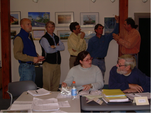
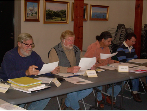
SUB COMMITTEE REPORTS

As of December. 2006, 13 of the HRTC's 14 sub committee's have reported back to the full Committee and 12 final reports have been accepted. These sub com reports contain information that will contribute to the restoration plan.

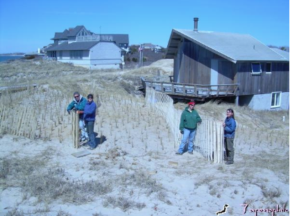
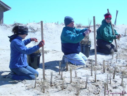
1. Vegetation Management Issues (approved August, 2006). Study of vegetation volumes, types and locations within the flood plain. Woody stemmed, intrusive upland vegetation will need a careful management plan, for removal prior to being killed by salt water. If the restoration were done in an incremental manner, vegetation could be removed sequentially. Approximately 600 acres of vegetation may require management effort. Various methods and techniques were presented. Options for disposal included: cut and sold as biomass for fuel; cut and burned on site; allowed to naturally transition (in the case of some reedy vegetation). Members: Joel Fox; Stephen Spear; Carl Breivogel; Gordon Peabody. 2. Stakeholder Issues (presented August, 2006). Just over sixty questions were gathered from residents, abutters and the Stakeholders Committee. Questions of a technical nature were answered prior to the early January, 2006 Wellfleet Selectmen's meeting. Questions regarding restoration management were answered as the HRTC began studying planning issues. Members: Robert Hubby; John Riehl. 3. Education Issues (approved August, 2006). The restoration provides a unique opportunity to share "real time" educational material. Teaching and learning concepts, from digital to on site and techniques from newsletters to a "restoration trail" were presented. Members: Robert Hubby; John Portnoy; Gordon Peabody.

4. Migration Issues (approved September, 2006). Multi species, anadromous and catadromous migrations were researched. Critical migration time windows were determined. Members: Andy Koch; Diane Murphy; Carl Breivogel.

5. Budget and Grants (approved October, 2006). Outlines potential budget issues, funding sources and grant timelines. Members: Tim Smith; John Portnoy; Stephen Spear; John Riehl. 6. Permitting Issues (approved October, 2006). Catalogues sequence of overall, multi-tiered permitting matrix, between federal, state and local agencies. Members: Hillary Greenberg; Tim Smith; John Portnoy. 7. Monitoring Issues (approved September, 2006). Provides catalogue of potential bio-indicators, parameters, protocols and sites for monitoring. Members: Diane Murphy, Andy Koch; Carl Breivogel; Gordon Peabody. 8. Restoration Histories, Lessons to be Learned (approved October, 2006). A study of New England's previous salt marsh restorations. Focus was on the nearby Hatches Harbor Restoration which provides a model for elements of our restoration plan. Common restoration problems were described. members: Tim Smith; Stephen Spear; Gordon Peabody.

9. Liaison (approved September, 2006). A catalogue of restoration partners with common interests (ecological, social, educational, administrative, financial and physical) in the restoration process. Members: John Riehl; Gordon Peabody.

10. Archives (approved October, 2006). Catalogue defining documents, electronic and hard copy, to be included in Public Record. Includes protocol for "Management and Disposition of Electronic Mail". Members: Robert Hubby; Gordon Peabody.

11. Outreach (approved October, 2006). Outlines protocol for volunteer program to be conducted through Association for the Preservation of Cape Cod (APCC), to conduct salinity monitoring. Members: John Riehl; John Portnoy. 12. Access (approved October, 2006). Catalogue of issues related to restoration area use, including shell fishing, fishing, boating, hiking and necessary support for such activities. Members: John Riehl; Gordon Peabody.

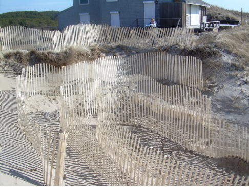
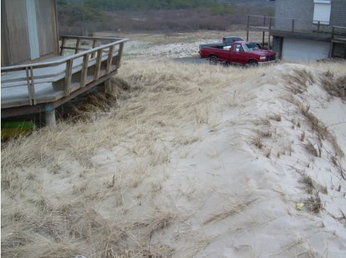
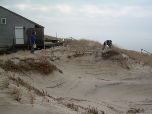
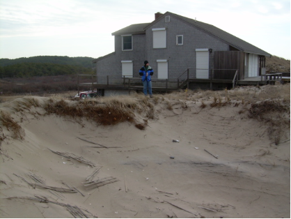
13. Restoration Impacts (interim report presented October, 2006). On going investigation of property, abutters, structures and road ways, which could be potentially impacted by restoration. Members: Jack Whelan; John Portnoy; Joel Fox; Gordon Peabody. 14. Administration (in process). Developing definitions of membership and responsibility for the future "Over Sight" Committee, which will implement restoration. Members: John Riehl; Robert Hubby; Hillary Greenberg; John Portnoy; Gordon Peabody.

Want More Information?

1. Numerous additional documents are available upon request. Please contact Gordon Peabody at 508-237-3724 or click here gordonsafeharbor@yahoo.com

2. For access to most recent documents, such as agendas, draft plans, minutes and chairman's notes, go to the CURRENT DOCUMENTS page, at the very top of this page.

3. Restoration Brochure, background and general information. Just click on the link below to read the brochure.

Herring River Restoration Project Brochure

Herring River Restoration: Update

Working Groups were appointed, during the fall of 2006, to work on shorter term issues. "Working groups" may include participants outside of the Committee membership when necessary. These groups provide regular reports to and receive direction from, the full Committee.

MOU II Working Group is meeting every two weeks. Meeting locations are intentionally alternated, between Cape Cod National Seashore Headquarters and town halls in Truro and Wellfleet. From left: Hillary Greenberg; Rex Peterson; John Portnoy; Gary pa…

MOU II Working Group is meeting every two weeks. Meeting locations are intentionally alternated, between Cape Cod National Seashore Headquarters and town halls in Truro and Wellfleet. From left: Hillary Greenberg; Rex Peterson; John Portnoy; Gary palmer; Carrie Phillips; Gordon Peabody

1. Brochure. The Wellfleet Conservation Trust contributed $2,000 to sponsor an informational brochure describing the restoration effort. MA Coastal Zone Management contributed formatting and layout and MA Corporate Wetlands Partnership contributed $500 to cover additional printing costs. The brochure is currently available on the Outer Cape and by request (at no cost) from gordonsafeharbor@yahoo.com. Members: Tim Smith; John Portnoy; Stephen Spear; Gordon Peabody; Peter Hall, Wellfleet Conservation Trust; Dennis O'Connell, Wellfleet Conservation Trust.

2. Newsletter. The HRTC is creating a semi-monthly newsletter, to continue the outreach information stream initiated by the brochure. Members: John Portnoy; Tim Smith; Stephen Spear; Gordon Peabody.

3. Mosquitoes and Drainage. Working to develop a comprehensive, integrated, management plan to define healthy marsh habitat as a function of tidal flushing. Members: John Portnoy; Stephen Spear; Gordon Peabody; Gary Palmer; Gabrielle Sakolsky (Cape Cod Mosquito Control Program or CCMCP). This Working Group's final report (4th revision) was unanimously approved at the 3/19/07 HRTC meeting. This report is available on the CURRENT DOCUMENTS page

4. Low Lying Roadways. New Working Group appointed 3/19/07. Reviewing overflight and ground based data from ENSR consultants to determine specific areas of roads within the flood plain, paved and unpaved, which could eventually be impacted by incremental restoration. Working Group includes Town of Wellfleet DPW, John Riehl, and others to be named at 4/12/07 HRTC meeting. Town of Truro DPW will also be invited to the April 12 meeting.

5. By Pass Working Group. Newly appointed members will more formally research and act as liaison between the HRTC and Public Safety officials regarding use of a by pass during construction work at the Chequessett Neck dike. High Toss Road is being considered. This could save nearly a million dollars for the restoration project in construction delays and savings if a "by pass" was feasible. This might include widening turns, some grading and brush cutting and locating a water tank somewhere on the West side of the Herring River for fire emergencies. This tank would need to be underground because dike reconstruction would need to occur in winter due to numerous considerations such as human and migratory fish traffic.

5. Second Memorandum of Understanding (MOU II). The restoration of the Herring River needs to be coordinated between Federal (Cape Cod National Seashore or CCNS) and Local (towns of Truro and Wellfleet) entities. These critical, inter-governmental relationships need to be defined in a document referred to as a "memorandum of understanding". This MOU needs to determine the roles and responsibilities of the three entities. Members: Gary Palmer, Truro Board of Selectmen (and HRTC); Rex Peterson, Wellfleet Assistant Town Administrator; John Portnoy, CCNS (and HRTC); Carrie Phillips, CCNS Natural Resources Director; Hillary Greenberg, Town of Wellfleet Health and Conservation (and HRTC); Gordon Peabody HRTC .

Want More Information?

1. Numerous additional documents are available upon request. Please contact Gordon Peabody at 508-237-3724 or click here gordonsafeharbor@yahoo.com

2. For access to most recent documents, such as agendas, draft plans, minutes and chairman's notes, go to the CURRENT DOCUMENTS page, at the very top of this page.

3. Restoration Brochure, background and general information. Just click on the link below to read the brochure.

Herring River Restoration Project Brochure