WORKING IN AREAS OF CRITICAL CONCERN: ENVIRONMENTAL EDUCATION SERIES

Download "Understanding The Coastal Process"
The Earth's three-dimensional landforms traditionally represent symbols of security. Things are very different on Cape Cod which is a temporary creation of glacial sand. Our three-dimensional landform is constantly being refined by another dimension: the fourth dimension of time. The four dimensional model does not symbolize security the grains of sand we live on were once mountaintops, thousands of feet high, hundreds of thousands of years ago. Weathering (exposure to the elements) de-constructs mountains chemically and physically, leaving behind indestructible granite particles. These sandy, mountain memories were carried down thaw swollen brooks and stream into rivers. The river's journey is over when it finds the sea. The burden of sand can be released. Heavier sand drops out near the coast, while finer, lighter particles are carried out to sea. Moon generated tidal currents, run parallel to the coast, transporting sand up and down the coastline. Wind generated wave patterns deliver the sand shoreward onto beaches. Seasonal winds continue moving this sand from beaches into sand dunes. The dunes closest to the beach have the heaviest sand particle mix. The dunes furthest from the beach have the lightest particle mix.

June 12, 1984 Cape Cod - image source: NASA Earth Observatory

August 17, 2008 image source: NASA Earth Observatory
During the last hundred thousand years or so, New England's coastal beaches had a visit from another mountain. This time it was a mountain of ice. Nearly a mile thick, grinding inexorably and crudely down from the north. Heavy enough to depress our continental plate, this thousand mile wide bulldozer stole boulders, cobbles, stones and beach sand on its way south. Where cape cod sits today, warmer weather patterns melted ice as fast as it advanced. This glacial aftermath was first exposed to daylight around twelve thousand years ago. Climate change and subsequent advances and retreats of the glacier eventually left a four hundred foo high pile of sandy rubble where Cape Cod is today. At that time Cape Cod was several hundred feet above the dry coastal plate, reaching eastwards a mile or two further than it sits today. Compressed layers of bright sand and colored dark clay marked the glacial seasons of high and low melt-water flow. Small greenish stones found on our beaches are olivine, from the laurentian field in Canada. Six thousand years ago, give or take, rising sea level from the melted glacier reached Cape Cod, to begin taking back what it had left behind.

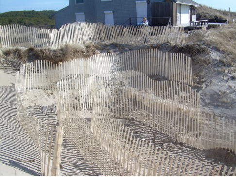
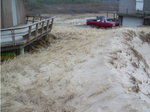
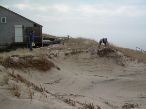
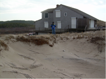
THE OUTER CAPE'S EAST-FACING SHORELINE IS A LIVING "WORKSHOP IN PROGRESS", DEMONSTRATING THE PRINCIPLES OF COASTAL PROCESS. OCEAN STORM ENERGY CREATES WAVES THAT ERODE BEACHES. BEACH EROSION CAUSES COASTAL BANKS TO COLLAPSE. COLLAPSED BANKS CREATE A "TOE" AT THE BASE OF THE NEW BANK. THE TOE ERODES ONTO THE BEACH AND THE BEACH MAY ERODE UP INTO THE TOE. WHEN BEACHES ABSORB STORM GENERATED WAVE ENERGY, SAND IS CARRIED OFF SHORE. THIS MATERIAL CREATES SAND BARS, PARALLEL TO THE SHORELINE. THE SAND BARS BEGIN TO ABSORB WAVE ENERGY AND BEACH EROSION DIMINISHES. STORM WAVES ALSO TRANSPORT SAND NORTH OR SOUTH ALONG SHORE. TIDAL CURRENTS MOVE SAND NORTH AND SOUTH, PARALLEL TO THE COAST. WAVE PATTERNS IN CALMER TIMES MOVE SAND BACK ONTO THE BEACH, THOUGH IT IS A DIFFERENT BEACH, NORTH OR SOUTH. DURING THE NEXT STORM, WHEN THE BEACH ERODES AGAIN, THE TOE OF THE COASTAL BANK SLUMPS DOWN TO RENOURISH THE BEACH. WHEN THE TOE BECOMES EXHAUSTED, THE COASTAL BANK COLLAPSES, CREATING A NEW TOE AND A NEW SUPPLY OF SAND. . THIS OVERALL PROCESS RESULTS IN A NET LOSS FOR THE OUTER CAPE SHORELINES. ONLY TWO AREAS ENJOY A NET GAIN, PROVINCETOWN TO THE NORTH AND CHATHAM TO THE SOUTH. BOTH TOWNS POSSES SOME OF THE NEWEST LAND ON THE PLANET. BEACHES ALONG THE COASTLINE OFTEN REVEAL LAYERS OF PEAT FROM MARSHES WHERE THE COASTAL PROCESS CREATED BARRIER BEACHES AND THEN DESTROYED THEM. THE DRIVING FORCE FOR INCREASING EROSION RATES ARE PROJECTED INCREASES IN SEA LEVEL, STORM FREQUENCY AND STORM INTENSITY. ALL OF THESE INCREASES ARE ATTRIBUTABLE TO CLIMATE CHANGE.

All that remains of the home in the beginning of this article. You may recognize this as apart of our Safe Harbor Banner, representing conflict with Natural Processes.
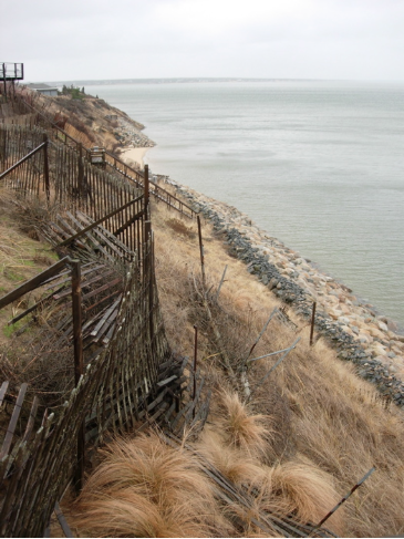
BACKSHORE EROSION RATES CAN BE ZERO, EIGHTEEN INCHES, SIX FEET OR FIFTEEN FEET IN ONE YEAR. THE CURRENT ACCEPTED AVERAGE IS SOMEWHAT OVER THREE FEET A YEAR. THIS IS THE AVERAGE FOR THE ENTIRE STRETCH OF BACKSHORE COASTLINE. PREVENTION OF COASTAL EROSION OFTEN INCLUDES STRUCTURAL, OR "HARD SOLUTION" RESPONSES. THESE MAY ONLY ADDRESS ONE POINT OF EROSION BY REDIRECTING WAVE ENERGY. THE COASTAL PROCESS RESPONDS TO MANY HARD SOLUTIONS BY ACCELERATING EROSION AT EACH END OF THE STRUCTURE (END SCOURING).
PERHAPS A BETTER CONCEPT WOULD BE "TOE REPLACEMENT". WHEN A COASTAL BANK BECOMES ERODED, DELIVERED SAND WOULD REPLACE THE TOE. THIS WOULD CONSTITUTE A "SOFT SOLUTION". HARD SOLUTIONS WILL EVENTUALLY DEVELOP SOME OF THE HYBRID CHARACTERISTICS OF SOFT SOLUTIONS. ONE EXAMPLE WOULD BE BUILDING A HARD SOLUTION SEAWALL BUT CREATING AND MAINTAINING A RENOURISHED TOE AT THE BASE OF THE WALL.
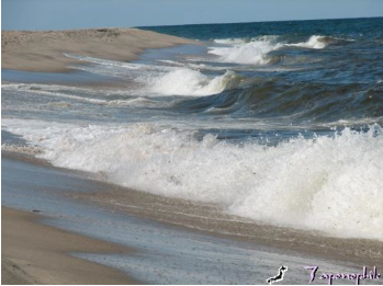
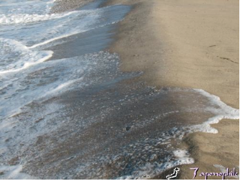
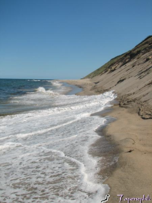
Wave Action as an Element of the Coastal Process


WIND AS AN ELEMENT OF THE COASTAL PROCESS
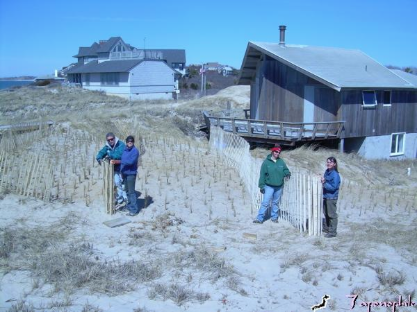
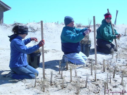
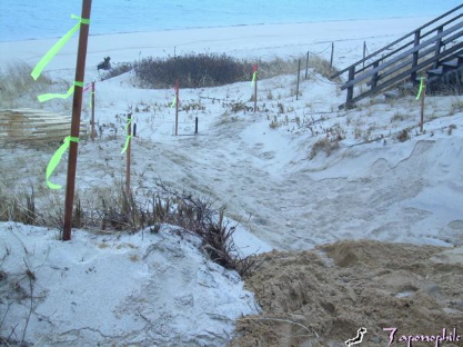
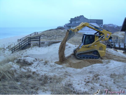
Safe Harbor 2009 For more information on this coastal dune restoration, check out our Images page or Gordon Peabody, 508-237-3724 or click here gordonsafeharbor@yahoo.com